Flathead Wild & Scenic River
Quick Facts
The Flathead River system was the inspiration behind the Wild & Scenic River Act of 1968 that created the National Wild & Scenic Rivers System.
Flathead Watershed

Whitefish Lake Institute. Flathead Watershed Map. Montana Lake Book 3rd Edition. https://mtlakebook.org
The Flathead River Basin comprises 6 million acres of forests, agricultural land, and relatively small communities, in the heart of the 18 million acre Crown of the Continent ecoregion. This ecoregion is one of the most ecologically diverse and intact landscapes remaining in North America and is a globally significant climate-change refuge.
The Three Forks of the Flathead River contributes 85% of the water flowing into Flathead Lake, the largest natural freshwater lake west of the Mississippi River and is the largest tributary of the headwaters of the Columbia River. Additionally, the Flathead River system is one of the last strongholds for the native Westslope Cutthroat trout where some of the largest conservation projects in the country are aimed at restoring this species to the Three Forks.
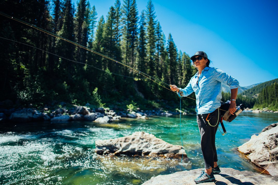
Three Forks of the Flathead River

Three Forks of the Flathead River. FLOAT GUIDE. Montana. 2015. Wild & Scenic River. United States Department of Agriculture. Forest Service.
Three Forks of the Flathead River also referred to as Flathead Headwaters include the traditional lands of the Séliš (Salish), Ql̓ispé (Pend d’Oreille or Kalispel), and Ktunaxa (Kootenai) tribes and frequented by the Amskapi Piikani (the Blackfeet Nation of Montana) Peoples. Archaeological evidence of human existence in the Flathead Watershed dates back to soon after the last ice age, over 10,000 years ago. Glacial scour and melting erased most evidence of early native ancestors, but their lives are revealed in oral accounts, artifacts, and ancient sites.
The North (aka Transboundary Flathead), South, and Middle Forks of the Flathead River drain approximately 4,464 square miles in northwestern Montana and southeastern British Columbia. Three Forks of the Flathead River encompass the North Fork of the Flathead originating in British Columbia to its confluence with the Middle Fork, the entire Middle Fork originating in the Bob Marshall Wilderness Complex, and the South Fork from its headwaters in the Bob Marshall Wilderness Complex to Hungry Horse Reservoir. A total of 219 miles of the Flathead River are included in the designation (does not include Canadian portion of North Fork).
Quick Facts
Designation
National Wild & Scenic Rivers System includes only 13,413 river miles - less than 1/2 of 1% of rivers are protected through this designation.
Montana has approximately 169,829 miles of river, 388 miles are designated as Wild & Scenic - approximately 0.2% of the state’s river miles.
Montana’s three protected rivers are the three forks of the Flathead River (1976), Missouri River (1976) and East Rosebud Creek (2018).
Middle Fork of the Flathead River inspired the 1968 Wild & Scenic Rivers Act. The twin Craighead brothers knew that the Middle Fork was the wildest river remaining in Montana and helped champion the protection of the river system when they learned of Spruce Park Dam proposal. John Craighead made the case for protecting the Flathead and other rivers in the 1957 issue of Montana Wildlife and their efforts and others eventually resulted in a National Wild & Scenic Rivers System.
Spruce Park Dam would have involved a tunnel through the mountain range from the Middle Fork drainage to the South Fork drainage to deliver water to Hungry Horse Reservoir. It would have dewatered the Middle Fork of the Flathead River.
Montana Senator Lee Metcalf was one of the sponsors of the Wild & Scenic Rivers Act, and his action in itself was an evolution of the conservation ethics of a politician of that time, as he was on record as pro-dam building earlier in his career.
Three Forks of the Flathead River possessed such outstanding qualities that in 1976 Congress added 219 miles of the Flathead River to the nation’s Wild & Scenic River System.
85% of the shoreline miles of the three forks of the Flathead River are managed by the Flathead National Forest or Glacier National Park.
Fisheries
Flathead River system is one of the last strongholds for the native westslope cutthroat trout. MT Fish, Wildlife & Parks fisheries biologists have led some of the largest conservation projects in the country aimed at restoring native westslope cutthroat trout, on the three forks of the Flathead River.
Wildlife
Three Forks of the Flathead River lie at the heart of the Northern Continental Divide Ecosystem (NCDE), an area with the largest population of grizzly bears in the lower 48 states.
The goat lick on the Lower Middle Fork is a geologic feature with an exposure along the riverbank of the Roosevelt Fault containing salts, including gypsum, kieserite and sulfates, which are frequently utilized by mountain goats.
Geology
Geological exposures that dominate all three segments of the Flathead River system are units of Belt Subgroup. Belt Subgroup units were deposited in a shallow sea located along western edge of North American continent approximately 1.47 to 1.37 billion years ago.
Colorful rocks found on the three forks of the Flathead River consist of low-grade metamorphosed sedimentary rocks: argillite (highly compacted mudstones), quartzite (metamorphosed sandstones), and limestone.
Geologic Outstanding Remarkable Values (ORVs) are: 1) Fossils of parasitic wasps, 2) Mineral goat lick, 3) Meadow Creek Gorge, and 4) Colored riverbed rocks.
Ethnography
Archaeological evidence of human existence in the Flathead Watershed dates back to soon after the last ice age, over 10,000 years ago.
Glacial scour and melting erased most evidence of early native ancestors, but their lives are revealed in oral accounts, artifacts, and ancient sites.
Middle (circa 7,500 to 2,500 years BP) use, but mostly Late Prehistoric Period sites (2,500 BP to 1,750 AD) associated with Salish, Pend d’Orielle, Kootenai Tribes and Blackfeet use.
North Fork of the Flathead River originates in British Columbia the traditional homelands of the Ktunaxa peoples.
Water
The North, South and Middle Forks of the Flathead River drain approximately 4,464 sq miles with an average annual discharge of 9,699 cfs, as measured in Columbia Falls. Together they contribute 85% of the water entering Flathead Lake.
Additional Information
"Rivers and their watersheds are inseparable, and to maintain wild areas we must preserve the rivers that drain them."
— John Craighead